In today’s data-driven landscape, visualizing complex datasets is essential for gaining insights and making informed decisions. One compelling application is the visualization of flight data. This article will explore how to work with a flight dataset in CSV format and create an engaging map representation that highlights flight paths, airports, and routes.
Understanding the Flights Dataset CSV
A flights dataset in CSV (Comma-Separated Values) format typically contains extensive information about air travel. This can include flight numbers, departure and arrival times, airport codes, aircraft types, and even delay information. The straightforward structure of a flights dataset CSV makes it easy to parse and manipulate in programming environments like Python or R.
Here’s an example of what a flights dataset CSV might look like:
Flight Number Departure Airport Arrival Airport Departure Time Arrival Time Distance
AA123 JFK LAX 2024-01-01 08:00 2024-01-01 11:00 2475
UA456 ORD SFO 2024-01-01 09:00 2024-01-01 12:30 1845
This structure allows you to extract essential information for visualization, making it easier to create a map representation.
Why Map Representations Matter
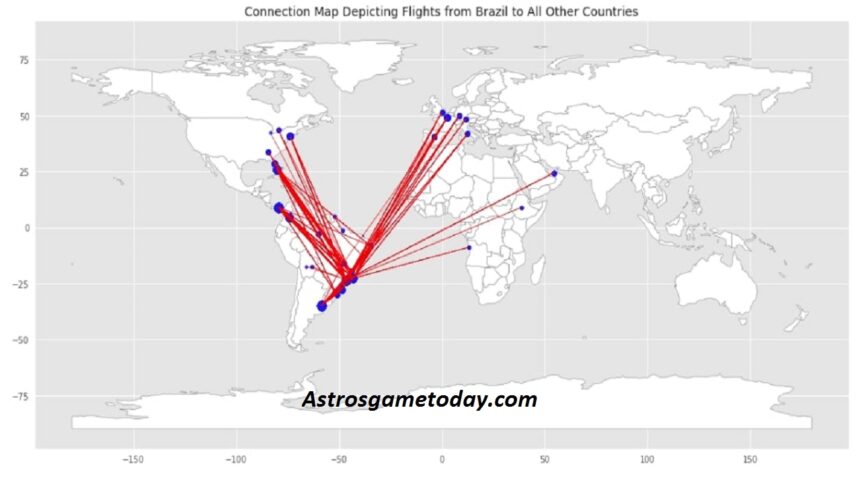
Visualizing flight data on a map offers numerous advantages. Rather than sifting through rows of numbers, stakeholders can quickly grasp patterns such as popular routes or congested airports. This can be invaluable for airlines, travel agencies, and travellers alike.
For instance, a map can reveal the most common flight paths between significant cities, aiding airlines in optimizing their routes. It can also help travellers identify the best connections and layovers. Furthermore, when visualized effectively, a flight dataset CSV can provide insights into seasonal travel trends and airport performance.
Tools for Mapping Flights Dataset CSV
Several tools and libraries can facilitate creating a map representation from a flight dataset CSV. Some popular options include:
- Python Libraries: Matplotlib, Folium, and Geopandas are excellent for data manipulation and visualization.
- R Packages: ggplot2 and leaflet are great for creating static and interactive maps.
- GIS Software: Tools like QGIS or ArcGIS provide advanced mapping capabilities, though they may require more expertise.
In this article, we will focus on using Python with the Folium library due to its user-friendly syntax and ability to create interactive maps from a flights dataset CSV.
Preparing the Dataset
Before creating the map representation, prepare your flight dataset CSV. Here’s how you can do it using Python:
- Install Required Libraries: Ensure you have the necessary libraries installed.
- bash
- pip install pandas folium
- Load the Data: Use Pandas to read your flights dataset CSV.
- Python
- Copy code
- Import pandas as PD
- # Load the dataset
- df = pd.read_csv(‘flights_data.csv’)
- Data Cleaning: Check for missing values or inconsistencies.
- Python
- Copy code
- df.dropna(subset=[‘Departure Airport’, ‘Arrival Airport’], inplace=True)
- Extract Coordinates: For mapping, you need the geographic coordinates of airports. You may need to create a mapping of airport codes to their latitude and longitude:
- python
- Copy code
- airport_coords = {
- ‘JFK’: (40.6413, -73.7781),
- ‘LAX’: (33.9428, -118.4108),
- ‘ORD’: (41.9742, -87.9073),
- ‘SFO’: (37.6213, -122.3790)
- }
Creating the Map Representation
With your dataset prepared, it’s time to create the map representation. Here’s a step-by-step guide using Folium:
- Initialize the Map: Create a base map centered on a geographic location.
- python
- Copy code
- import folium
- # Initialize a map centered around the USA
- flight_map = folium.Map(location=[37.0902, -95.7129], zoom_start=4)
- Add Flight Routes: Iterate over your dataset to add lines between airports.
- python
- Copy code
- for index, row in df.iterrows():
- departure_coords = airport_coords[row[‘Departure Airport’]]
- arrival_coords = airport_coords[row[‘Arrival Airport’]]
- folium.PolyLine(locations=[departure_coords, arrival_coords], color=’blue’, weight=2.5, opacity=0.5).add_to(flight_map)
- Add Markers: You can also add markers for each airport.
- python
- Copy code
- for airport, coords in airport_coords.items():
- folium.Marker(location=coords, popup=airport).add_to(flight_map)
- Save the Map: Finally, save the map as an HTML file.
- python
- Copy code
- flight_map.save(‘flight_map.html’)
Enhancing Your Map
To make your map representation from the flights dataset CSV more engaging and informative, consider adding features such as:
- Interactive Popups: Show flight details when clicking on the flight paths or airport markers.
- Heatmaps: Use heatmaps to visualize flight frequency between routes.
- Time Slider: Incorporate a time slider to view flight activity over different periods.
- Filtering Options: Allow users to filter flights by criteria such as airline, distance, or delays.
Real-World Applications
The ability to visualize flight data through a flights dataset CSV and create a map representation has far-reaching implications:
- Airline Management: Airlines can optimize their routes based on passenger demand and performance data.
- Travel Planning: Travelers can use visualizations to find the best routes and times to fly.
- Research and Analysis: Researchers can study patterns in air traffic, such as the impact of seasonal trends on flight availability.
Challenges and Considerations
While creating a flights dataset CSV map representation can be immensely beneficial, there are some challenges to consider:
- Data Quality: Ensure your dataset is accurate and up-to-date to avoid misleading representations.
- Complexity of Data: As the dataset grows, managing and visualizing it can become cumbersome.
- Technical Skills: Not everyone has the coding skills to manipulate data and create visualizations, which may limit accessibility.
Conclusion
Visualizing flight data through a flights dataset CSV and creating a map representation opens up a world of insights into air travel. By following the steps outlined in this article, you can transform a raw dataset into an engaging, informative visualization that aids decision-making in the aviation industry and enhances the travel experience for individuals.
The keyword “flights dataset CSV get a map representation” encapsulates the journey from data to visualization, highlighting the importance of effective data presentation in our increasingly complex world. By leveraging tools like Python and Folium, anyone can unlock the potential of their flight data, paving the way for deeper understanding and informed decision-making in air travel.
As you embark on this journey, remember that the possibilities are vast. The world of flight data awaits—go ahead and explore it through the lens of mapping!
With the right approach and tools, you can effectively use a flights dataset CSV to get a map representation that serves both analytical and practical purposes.
May Also Read: Exploring Selena Gomez’s Net Worth: A Deep Dive into Her Wealth and Success